REVIEW · KAMPALA
Rwenzori Mountains Trekking with Margherita Peak Summit
Book on Viator →Operated by Bujuku Eco Tours & Travel Ltd · Bookable on Viator
A seven-day trek can still feel like a moving museum. This Rwenzori Mountains route has you hike through mountain forest and high-alpine bogs, then aim for Margherita Peak (5,109m) in the Rwenzori Mountains National Park. It’s a classic “mountains of the moon” style adventure where the plants look like they belong on another planet—and the air gets real thin near the top.
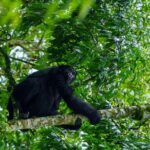
Two things I like a lot: the itinerary’s long days are broken up with clear hut-camp stops, and the route is built around real altitude rhythm. You also get plenty of chances to see wildlife such as black-and-white colobus and the Rwenzori turaco, with standout stretches through giant heather, lobelia, and groundsel zones.
One consideration: climbing gear isn’t included, and Margherita is a tough, exposed day with ice and slippery rock. If you’re not already comfortable with glacier-style terrain, plan for training time and gear prep before you arrive.
In This Review
- Key highlights to clock before you go
- Entering Rwenzori Mountains National Park via Nyakalengijja and the Mubuku River
- Kurt Shafer Bridge to John Matte Hut: bamboo, slippery moss rock, and giant flora
- Lower Bigo Bog and Bujuku Lake: giant lobelias and cold bog reality
- Groundsel Gully to Elena Hut or Kitandara Lakes: a fork in the plan
- Margherita Peak (5,109m): three glaciers, exposed rock, and weather discipline
- Freshfield Pass (4,282m) and the historic Bujongolo area
- Kichuchu cliffs and the circuit back to Mihunga gate
- Value check: is $1,400 fair for a Margherita summit trek?
- Guides, support, and the human side you’ll feel on hard days
- What to pack if climbing gear isn’t included
- Who this trek suits—and who should reconsider
- Should you book the Rwenzori Mountains trek to Margherita Peak?
- FAQ
- FAQ
- Where does this trek take place?
- How long is the trek?
- What summit does the trek target?
- Are meals included?
- Is pickup included?
- Is climbing gear included?
- What fitness level is required?
- Is the tour private?
- Can I cancel for a full refund?
Key highlights to clock before you go
- Margherita summit focus (5,109m): a full, serious peak day with glaciers and exposed scrambling.
- Bog-country scenery and footing: slippery moss rock and bog crossings that can be wet and cold.
- High-altitude alpine plants: giant heathers, lobelias, and groundsel fields you won’t see elsewhere in Uganda.
- Historic mountain connection: stops near Bujongolo, linked with the Duke of Abruzzi’s 1906 expedition.
- Hut-to-hut pacing: nights at Nyabitaba, John Matte, Bujuku, Elena, and Guy Yeoman camps help you recover.
- Support and communication: past trekkers praised professional guides, fast responses, and flexible organization.
Entering Rwenzori Mountains National Park via Nyakalengijja and the Mubuku River
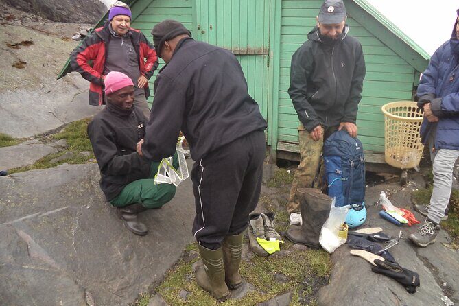
Your trek starts with a driver guide bringing you to Nyakalengijja for the briefing and equipment organization. From there, the first hiking feel is “green and alive.” The path passes farmland before it reaches the park boundary, then funnels into thick forest along the Mubuku River.
Day 1 keeps you climbing. After crossing the Mahoma River tributary, you tackle a long, steep rise up to Nyabitaba hut. This is the day to set your pace. Don’t race the climb because the forest trails can lull you into thinking you’re doing fine—until you notice your lungs working harder.
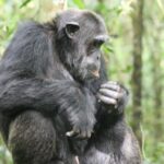
I also love that this first section offers wildlife without needing a special detour. In the right moments, you may hear chimpanzees and spot black-and-white colobus, blue monkeys, and the Rwenzori turraco—bright, oddly beautiful birds that make the forest feel even more magical.
You can also read our reviews of more hiking tours in Kampala

Kurt Shafer Bridge to John Matte Hut: bamboo, slippery moss rock, and giant flora
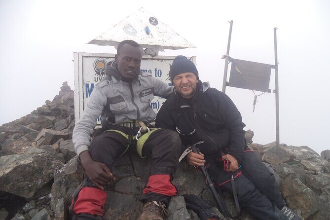
Day 2 drops from Nyabitaba down to Kurt Shafer Bridge, near where the Mubuku and Bujuku river systems connect. It’s a working-feet day: you move through forest, then hit bamboo, then step into a stretch of slippery moss-covered rock that can feel draining even when the distance isn’t huge.
After the long slog, you reach Nyamuleju rock shelter with views out toward Mount Stanley and Mount Speke. Then the hike shifts into high-altitude botany mode—giant heather, lobelia, and groundsel start showing up more clearly as you gain elevation.
You end at John Matte Hut for dinner and overnight. The practical win here is timing: this is a day where you’ll likely be tired from footing, not just from distance. That makes the hut stop meaningful—you can recover before the bog-and-lake day that follows.
Lower Bigo Bog and Bujuku Lake: giant lobelias and cold bog reality
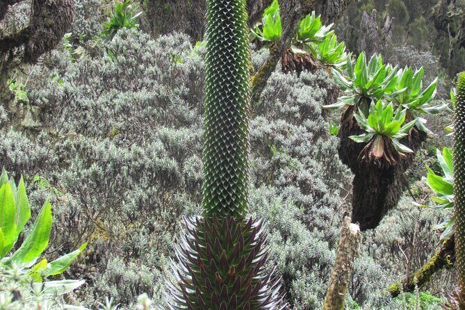
Day 3 is shorter than the previous one, but it can feel colder. You drop down to cross the Bujuku River and enter Lower Bigo Bog, a place known for giant lobelias. The crossing is described as jumping from tussock to tussock—use your trekking poles if you have them and keep your steps deliberate.
Here’s the honest consideration: the route notes that the bog crossing isn’t always clean and dry. You might end up with your feet sampling some freezing ooze. Plan for that mentally, and pack accordingly. Once you accept that your boots might get wet, the bog becomes less stressful and more “this is the Rwenzori.”
The day continues into upper bog, then toward Bujuku Lake. Views open up toward Mount Baker to the south and Mount Stanley to the west. You arrive at Bujuku Hut in the shadow of Mount Baker and Mount Speke, in a narrow valley below Stuhlmann Pass—an excellent acclimatization camp for anyone aiming at peaks like Mount Stanley and Mount Speke.
Groundsel Gully to Elena Hut or Kitandara Lakes: a fork in the plan
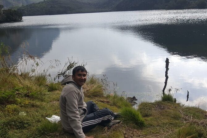
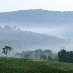
Day 4 is a great reminder that the Rwenzori route isn’t only about the summit. It’s also about the journey’s variety—bog, forest, boulders, and distinct zones of alpine plants.
Leaving Bujuku, you move through more bog, then climb steep slopes west of the lake. Groundsel Gully is called out as magical and forested, and you’ll feel that change in texture: trails that are firm enough to walk, then sections that feel slow and heavy underfoot.
Then you reach a key decision point:
- One branch heads to Elena Hut on a steep trail over large boulders. If you’re climbing Margherita Peak, dinner and overnight are at Elena Hut.
- Another option heads toward Kitandara Lakes and Kitandara Hut for those not climbing the peak.
Even if you’re set on Margherita, it helps to understand why Elena Hut matters. It’s your “peak prep” station, where the cold and altitude start feeling more real before the main summit push.
Margherita Peak (5,109m): three glaciers, exposed rock, and weather discipline
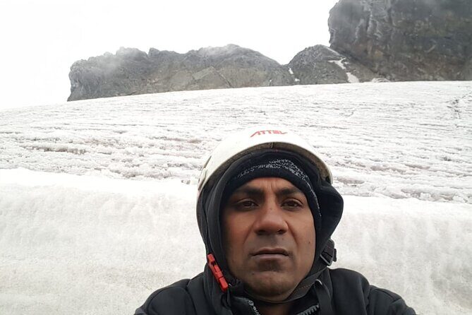
This is the big day. You start early and climb Margherita of Mount Stanley. The hike to the summit takes about 4–5 hours, depending on weather and your climbing pace.
The description here matters, because it’s not a stroll. The climb takes you over three glaciers, through slippery rock, ice, and very exposed areas that are open on many sides. This is where acclimatization pays off. The route notes you’ll likely be acclimatized to fog, altitude sickness risk, and cool weather by this stage—meaning your earlier days aren’t filler. They’re training for your body and your head.
Once you’re on the glaciated terrain, the route says you cross the Stanley Plateau and then continue the ascent. When conditions are right, the scramble to the summit feels like it’s happening inside a high-alpine world: cold air, wide sightlines, and a steep commitment to moving carefully.
Afterward, the descent back to Elena Hut takes about 2–3 hours. That shorter downward section can still be tricky. Going down over uneven ice and exposed terrain demands focus, not speed.
Freshfield Pass (4,282m) and the historic Bujongolo area
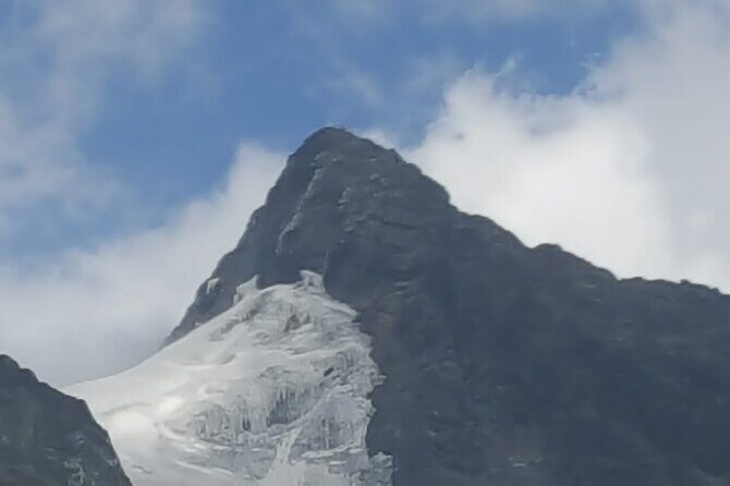
Day 6 takes you away from the peak day intensity and into a long, high-altitude walking rhythm. From Kitandara (for those on the full circuit route described), you ascend steeply up the headwall around the base of Mount Baker, then continue along the south side of the mountain to Fresh field Pass at 4,282m.
At the pass you can view into the Congo to the west and Mount Stanley to the north. That’s one of those “you remember this for years” moments—big views that make the hard walking feel worth it.
Then the hiking becomes a long high alpine traverse over mossy terrain before you start descending steep rocky trails. You pass the rock shelter at Bujongolo, noted as the base camp for the historic expedition by the Duke of Abruzzi in 1906. It’s a useful reminder that this mountain region has drawn serious explorers for more than a century.
You end the day at Guy Yeoman Camp for overnight.
Kichuchu cliffs and the circuit back to Mihunga gate
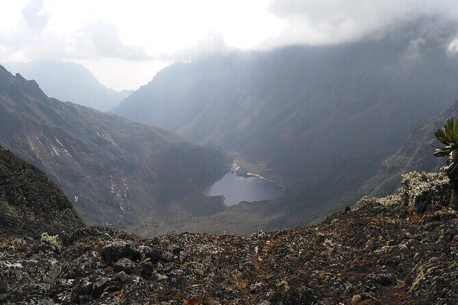
On Day 7, the route continues its circuit style: you descend below Guy Yeoman via the cliffs of Kichuchu, then move beyond Kichuchu onto a muddy path that crosses the Mubuku River twice through bamboo forest.
The bamboo forest sections are a nice change of texture from bog and rock. They also help you relax your mind a bit because you’re moving through a more familiar “forest trail” feel.
From there you keep descending toward Nyabitaba to complete the circuit, then continue down from Nyabitaba Camp to finish by evening at Mihunga gate. If your knees are talking by now, you’ll appreciate that the last day is still about consistent movement rather than another big technical push.
Value check: is $1,400 fair for a Margherita summit trek?
At $1,400 per person for a roughly 7-day private trek, the question isn’t just the price—it’s what you’re buying.
You’re paying for:
- A guided route through a complex environment (bogs, huts, and the exposed Margherita summit day).
- Seven days of breakfast, lunch, and dinner (so you’re not doing food logistics while you’re busy climbing).
- A service structure that includes a driver guide and an included pick-up option.
- Park-entry noted as free in the itinerary (at least as listed day-by-day).
The “cost pressure” comes from what you don’t get: climbing gear isn’t included. If you already own boots suited to wet cold terrain and you know how you’ll handle glacier-style days, this becomes a solid deal for what you’re attempting. If you still need to buy everything from scratch, your total trip cost goes up quickly.
So my take: this looks like good value if you’re gear-ready and physically prepared, and you want a structured hut-to-hut summit attempt without you piecing together the logistics yourself.
Guides, support, and the human side you’ll feel on hard days
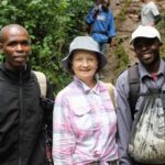
In the reviews, the strongest themes are clear: communication is fast, the organization feels reliable, and guides are professional and friendly. People specifically mention being helped with everything and being able to ask questions—exactly what you want when you’re doing a serious climb.
Names that pop up include Johnson, Geoffrey/Geofrey, and Joeffery. Past trekkers also credit the team with flexible planning. That flexibility matters in the real world of weather and health, especially on summit days where timing and conditions can change.
There’s also a safety-and-management angle tied to the trek, with people noting security and well-managed logistics. That’s not a guarantee that every day is easy, but it does mean the operation is set up to handle the mountain’s ups and downs with a plan.
And yes, some reviews mention socially conscious choices by the company. I can’t verify what you’ll see on the ground from your trip info alone, but the overall pattern is that the operator tries to handle more than just the hiking part.
What to pack if climbing gear isn’t included
Since climbing gear isn’t included, you’ll want to get clarity early on what you must bring versus what you’ll be provided. The itinerary describes glaciers, ice, slippery rock, and exposed terrain on Margherita Peak, so assume you’ll need appropriate technical kit.
For your packing list, think in layers and in “wet cold” terms:
- Rain and wind protection for foggy, cold mountain weather.
- Warm insulating layers for nights at huts/camps.
- Gloves and headwear you can use when it’s chilly and possibly damp.
- Water and hydration habits that work even when you’re walking slowly over bog and rock.
- Footwear you trust on mossy, muddy, cold ground.
If you’re unsure about glacier-day gear, contact the provider before arrival. The worst time to learn you need something extra is after you’re already in the park.
Who this trek suits—and who should reconsider
This is best for people with moderate physical fitness who also understand that Margherita is not moderate in the summit sense. If your legs are in shape, your gear is ready, and you can handle exposed and icy terrain, you’re in the right lane.
You should think twice if:
- You’re new to high-altitude trekking and aren’t confident with altitude discomfort and cold.
- You hate the idea of wet bog crossings and slippery rock.
- You don’t have the right gear and you’ll be scrambling to buy it last minute.
On the other hand, if you want a route that mixes real wildlife habitat (like colobus monkeys and turaco), high alpine plant zones (giant heather and lobelias), and a true peak challenge with a structured circuit, this trip checks those boxes.
Should you book the Rwenzori Mountains trek to Margherita Peak?
If your goal is the Margherita summit attempt and you want an organized, hut-based route that takes you through the Rwenzori’s unique alpine environments, I think it’s a smart choice. The price feels fair for a private setup with meals, and the route design gives you acclimatization time instead of rushing straight to the high drama.
I’d book it if:
- You can secure appropriate climbing gear before you go.
- You’re willing to take your time on slippery and exposed sections.
- You like the idea of sleeping at established huts/camps and focusing on the trail.
I wouldn’t book it if you’re looking for a gentle nature walk. This is a serious mountain hike that includes bog travel, cold conditions, and a tough summit day.
FAQ
FAQ
Where does this trek take place?
It takes place in Rwenzori Mountains National Park in Uganda, starting with a briefing at Nyakalengijja and hiking through the park’s main mountain areas.
How long is the trek?
The duration is listed as 7 days (approx.).
What summit does the trek target?
The tour targets Margherita Peak (5,109m asl).
Are meals included?
Yes. Breakfast (7), Lunch (7), and Dinner (7) are included.
Is pickup included?
Pickup is offered, and the meeting point listed is Entebbe Airport (Entebbe, Uganda) with the activity ending back at the meeting point.
Is climbing gear included?
No. Climbing gear is not included.
What fitness level is required?
You should have moderate physical fitness.
Is the tour private?
Yes. It’s listed as a private tour/activity, meaning only your group participates.
Can I cancel for a full refund?
The experience has free cancellation, with a full refund if you cancel up to 24 hours in advance of the start time. If you cancel less than 24 hours before, the amount paid is not refunded.